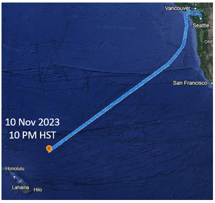
Since boarding the R/V Thomas G. Thompson, I have been thinking a lot about location: When will we pass Cape Flattery? Will we avoid a low-pressure system? Will we avoid a second low-pressure system? Where is the edge of the California Current? When will we start seeing light from Hawaii on the horizon? At some point in every wondering, I reach the realization that I have no clue where we are… luckily the ship and its fabulous crew do!
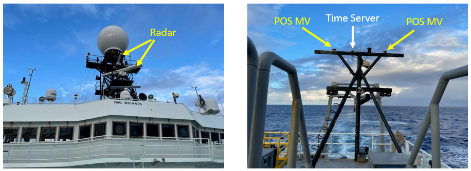
Knowing location is obviously important for navigation, but the R/V Thompson is also a research vessel that collects data at specific locations in the ocean. The ship needs accurate positions to ensure quality data. After some investigation, I decided that figuring out the navigation and positioning systems were way too complicated for this post. However, with help from the wonderful marine techs, I was able to identify several intriguing structures: the radar for the ECDIS (the main navigation system for the ship), the POS MV antennas (a highly accurate differential GPS), and a time server which communicates with satellites and the instruments onboard the ship to ensure all data is recorded with precise and accurate time stamps.

The ship collects and stores LOTS of location data…why not use some of the POS MV data to create a nice souvenir! (Can you figure out how we avoided those northern low-pressure systems:)


